Open Space in Little Compton

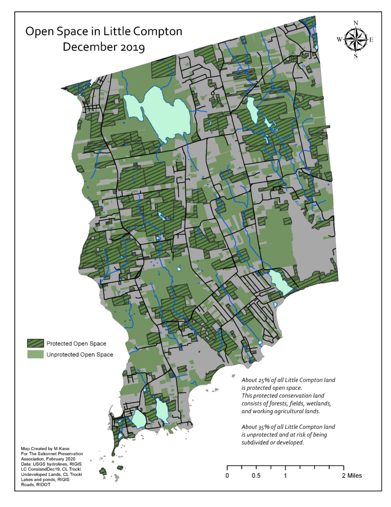
Open space includes forests, fields, wetlands, and working agricultural lands. 60% of Little Compton was open space as of December 2019.

A map of Little Compton with true North at the top & center of the page.  The base of the map is grey.  Dark green with crosshatching marks land that is protected/conserved open space. Light green marks unprotected open space.   Explanatory text reads: "About 25% of all Little Compton land is protected open space. This protected conservation land consists of forests, fields, wetlands, and working agricultural lands.    About 35% of all Little Compton land is unprotected and at risk of being subdivided or developed."  Text at bottom left describes maker and sources as follows. "Map created by M. Kane for the Sakonnet Preservation Association, February 2020. Data: USGS hydrolines, RIGIS LC ConslandDec19, CL Trocki Undeveloped Lands, CL Trocki Lakes and ponds, RIGIS Roads, RIDOT"